| Invention Name | Mariner’s Astrolabe (Nautical/Sea Astrolabe) |
| Short Definition | Hanging angle-measuring tool for Sun/Star Altitude to estimate Latitude |
| Approximate Date / Period | By about 1470 Approximate |
| Geography | Atlantic Europe (Iberian seafaring routes) |
| Inventor / Source Culture | Anonymous / collective (mariners & instrument makers) |
| Category | Navigation / Astronomical Instruments |
| Need It Addressed | Offshore positioning without land landmarks |
| How It Works | Altitude reading + declination data ⇒ Latitude |
| Material / Tech Base | Brass/Metal weight, degree scale, rotating alidade |
| First Main Use | Ocean navigation (Sun by day, stars at night) |
| Spread Route | Iberian practice → wider European seafaring |
| Derived Developments | Celestial navigation routines; later quadrant and sextant adoption |
| Impact Areas | Science, mapping, maritime trade, education |
| Precursors + Successors | Planispheric astrolabe → mariner’s astrolabe → quadrant, sextant |
| Debates / Different Views | Exact origin and “first maker” not fixed |
| Key Cultures | Islamic astronomical tradition; European maritime adoption |
| Influenced Variants | Open-frame, full-circle graduations, size variants |
| Why It Matters | Latitude finding Confidence for longer ocean routes |
The mariner’s astrolabe is a sea-ready version of the classic astrolabe, built to measure the altitude of the Sun or a bright star above the horizon. Its value was practical: a single angle, read from a degree scale, could support an estimate of latitude when paired with trusted astronomical tables. The instrument looks simple, yet it sits at the heart of early celestial navigation—a bridge between sky knowledge and open-water travel.
Contents
What It Is
A mariner’s astrolabe is best understood as a graduated metal circle with a rotating sighting rule called an alidade. Unlike the complex, flat “planispheric” astrolabe used on land, this sea version stripped away delicate parts and focused on one job: reading a vertical angle reliably enough to support latitude work. Royal Museums Greenwich notes the design as a simplified instrument for measuring the height of heavenly bodies and places its navigational use by about 1470.Details
Core Identity
- Purpose: measure Sun/star altitude above the horizon
- Output: a degree reading used in latitude estimation
- Design logic: weight and openwork help resist wind
Why It Appeared
On open water, landmarks fade fast. A navigator could still know direction from a compass, yet position needed something stronger than guesswork. The key gap was latitude: north–south placement that can be tied to the sky through the Sun’s height at midday or the altitude of a known star. The mariner’s astrolabe fit that need with a tough, sea-tolerant form—an instrument designed to hang, swing, settle, and still offer a usable angle.
Britannica describes how astrolabes were adopted by mariners by about the mid-15th century and later gave way to sextants as accuracy demands rose.Details In that long transition, the mariner’s astrolabe served as a practical midpoint: simpler than scholarly instruments, more specialized than early general-purpose angle tools.
Early Evidence and Timeline
The instrument’s story sits inside a wider astrolabe tradition—a family of tools with deep roots across cultures. The Museum of the History of Science at Oxford highlights the astrolabe’s two-thousand-year span and the breadth of its historical use across regions and eras.Details The mariner’s astrolabe is a focused branch of that larger lineage.
- Before the sea version: planispheric astrolabes thrive as scholarly instruments for time, altitude, and sky modeling
- Sea adaptation: a heavier, simplified form emerges for maritime latitude work (timing varies by source)
- Peak use: The Mariners’ Museum describes broad European use with popularity peaking in the 15th and 16th centuries.Details
- Gradual replacement: newer angle instruments tighten precision and reduce handling limits, shifting practice toward the quadrant and later the sextant
| Phase | Main Focus | Navigation Outcome |
|---|---|---|
| Land Astrolabe Era | Sky modeling, time, altitude | Astronomy support |
| Mariner’s Astrolabe Era | Altitude measurement at sea | Latitude estimates |
| Refined Angle Tools | Higher precision optics/design | More reliable fixes |
How It Works
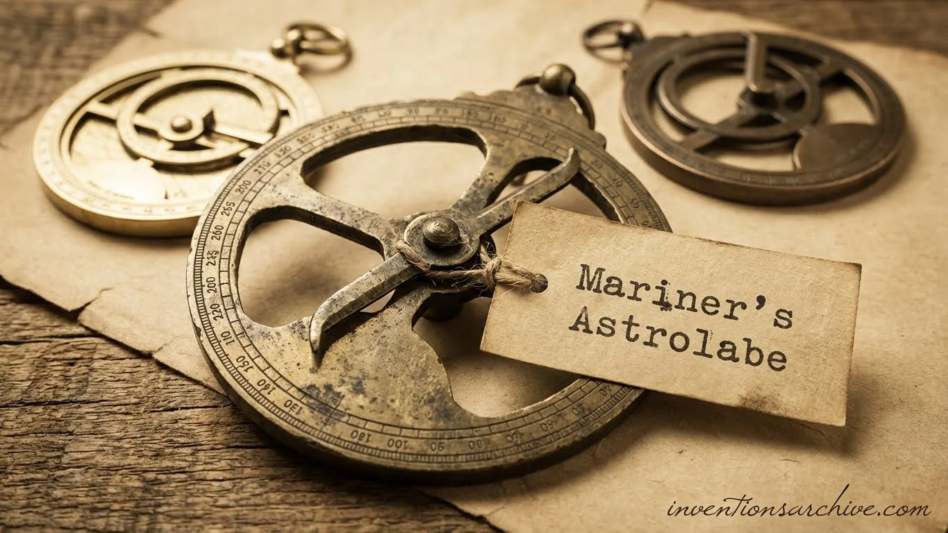
The mariner’s astrolabe reads one thing: the angle between a celestial body and the horizon in a vertical plane. It typically hangs from a ring so gravity defines “down,” while the alidade rotates until its sights align with the Sun or a star. The rim carries a degree scale, turning alignment into a number.
Key Parts
- Suspension ring: lets the body hang vertically
- Limb: the outer ring with degree graduations
- Open frame: cutouts that reduce wind push
- Alidade: rotating rule with sights (holes or slits)
- Center pin: pivot that keeps motion controlled
From Angle to Latitude
An observed altitude becomes meaningful when combined with the sky’s known geometry for that date. That is where declination tables matter: they provide the celestial body’s position relative to Earth’s equator, enabling latitude work from measured altitude. The U.S. Naval Observatory’s Astronomical Applications resources describe celestial navigation services and almanac-style outputs that include values such as declination for navigation calculations.Details
In plain terms, the instrument supplies a clean angle. The tables supply the day’s sky reference. Together they support a latitude estimate that is understandable, repeatable, and tied to physical observation.
Typical Observation Targets
- Midday Sun: a stable reference for daily latitude routines
- Pole Star: a familiar point for northern night observations
- Bright stars: used when conditions allow a clear sight line
Accuracy and Limits
Sea conditions shape every measurement. A mariner’s astrolabe can swing with the ship’s motion, and wind can nudge the hanging frame. That is why many examples are heavy and use cut-away designs to reduce wind resistance—an approach described by Royal Museums Greenwich when explaining the sea-ready form. Stability was the central design goal, even if perfect steadiness was never guaranteed.
Related articles: Sextant Precursor [Medieval Inventions Series], Astrolabe [Ancient Inventions Series]
Where It Shined
- Robust build for shipboard handling
- Clear purpose: altitude to support latitude
- Simple reading from a degree scale
What Held It Back
- Ship motion can blur the moment of sight
- Wind can add swing in exposed conditions
- Angle-only measurement: longitude remains outside its direct reach
Types and Variations
“Mariner’s astrolabe” describes a function more than a single fixed blueprint. Surviving instruments show variation in shape, graduation style, and how aggressively the frame is opened to pass wind. These differences reflect practical priorities: readability, durability, and steadiness.
Frame Style
- Open-frame: large cutouts, lower wind load
- Heavier rim: more inertia for smoother hang
- Spoke patterns: structural support with minimal surface area
Scale Choices
- Degree graduations: clearer reading at the limb
- Different step sizes: made for practical legibility
- Marking density: a balance between precision and clutter
Size and Handling
- Smaller bodies: easier storage, less inertia
- Larger bodies: more stable hang, clearer scale
- Suspension hardware: ring placement tuned for vertical balance
Legacy and Influence
The mariner’s astrolabe helped make latitude a routine shipboard idea: something measurable, recordable, and comparable across days. Its deeper legacy is cultural as much as technical. It represents a moment when mathematical sky knowledge became a practical maritime tool, built for salt air, wind, and imperfect horizons.
Later instruments improved precision and ease, yet they kept the same core principle: a measured angle ties the observer to the geometry of the sky. In that sense, the mariner’s astrolabe sits at the start of a long, calm lineage of measured navigation—careful observation, structured recording, and a steady respect for reliable data.
FAQ
Is A Mariner’s Astrolabe The Same As A Planispheric Astrolabe?
No. A planispheric astrolabe is a richer astronomical model with multiple plates and functions. A mariner’s astrolabe is a hardened, simplified angle reader built for sea conditions.
What Did It Help Measure On A Voyage?
It provided the altitude of the Sun or a star above the horizon. That angle could support an estimate of latitude when combined with trusted astronomical tables.
Why Was It Made Heavy?
Weight adds inertia. A heavier hanging body tends to resist small gusts and minor bumps, helping the instrument settle into a cleaner vertical orientation.
Could It Provide Longitude?
Not directly. The mariner’s astrolabe is a vertical-angle instrument. Longitude historically required additional methods and time-keeping approaches beyond what a single altitude reading could supply.
Why Did Other Instruments Replace It?
Newer tools improved precision and reduced the impact of motion and wind. Even as forms changed, the same idea remained: a measured angle linked to astronomical data can support navigation.