
| Invention Name | Nilometer; Arabic historical term: al-miqyās |
|---|---|
| Short Definition | A fixed river-level gauge used to measure the rise and fall of the Nile against a marked scale. |
| Approximate Date / Period | Flood-height records existed by the Early Dynastic period, around 3000 BCE; surviving built nilometers belong to several later periods. Approximate |
| Evidence Status | Based on surviving evidence Early written records, archaeological structures, inscriptions, measurement scales, and later administrative texts. |
| Geography | Nile Valley and Delta, especially Egypt; known settings include Elephantine, temple precincts in Upper Egypt, Delta settlements, and Rawda Island in Cairo. |
| Inventor / Source Culture | Anonymous / collective; developed through ancient Egyptian measurement, irrigation, temple, and administrative practice. Attribution varies |
| Category | Measurement, water management, agriculture, administration, and hydrology |
| Main Problem Solved | Turning a changing river level into a repeatable reading that could be compared with thresholds and earlier observations. |
| How It Worked | Nile water reached a marked column, stairway, wall, basin, or connected well; an observer read the water surface against a cubit-based scale. |
| Material / Technical Basis | Dressed stone, masonry wells, stairs, channels or culverts, inscribed scales, reference points, and in some forms a central stone or marble column. |
| Early Uses | Flood monitoring, irrigation preparation, agricultural assessment, record keeping, public announcements, and taxation linked to expected crop conditions. |
| Development Path | Natural river markers and measuring rods → fixed nilometer → recorded institutional gauge → mechanical and electronic river gauge |
| Main Types | Marked river steps or corridors; column-in-well forms; connected wells, cisterns, or basins; local hybrids. |
| Surviving Evidence | Architectural remains, engraved graduations, columns, stairways, channels, inscriptions, historical flood records, and museum or archive documentation. |
| Known Medieval Example | Rawda Island Nilometer, Cairo, ordered in 861 CE under the Abbasid caliph al-Mutawakkil. Confirmed by inscription and monument record |
| Importance |
|
| Affected Fields | Agriculture, measurement, water engineering, public administration, economic records, historical hydrology, and environmental observation |
| Related Inventions | Cubit rod, basin irrigation, canal system, staff gauge, stilling well, stream gauge |
| Modern Descendants | Staff gauges, float-operated stilling wells, pressure sensors, radar water-level sensors, data loggers, and telemetry stations |
| Main Uncertainty | The earliest recorded flood height is not the same as the earliest surviving nilometer structure; the invention cannot be assigned securely to one builder or one date. |
What The Nilometer Was
A nilometer was a fixed instrument for reading Nile water level. It translated the height of the river into a numbered or marked value. The simplest principle was the same as a permanent ruler placed where the water could reach it, though the architecture could be much more elaborate.
The term describes a family of structures, not one standard machine. A nilometer might be cut into a riverbank, built as a stairway descending toward the water, formed as a basin, or placed inside a well connected to the Nile. What joined these forms was a stable reference point and a scale that made observations comparable.
A Measurement System, Not One Object
- The observed quantity was river stage: the height of the water surface relative to a fixed mark or datum.
- The reading used a scale: often expressed in cubits and smaller divisions suited to the local installation.
- The setting mattered: a gauge had to remain connected to the river or its water level while resisting erosion, sediment, and pressure.
- The reading gained value through records: one measurement described a moment; a series allowed comparison across days, seasons, and years.
How Its Origin Is Traced
Researchers trace the nilometer through two related evidence streams: records of annual flood heights and surviving or excavated measuring structures. The first shows that systematic observation began very early. The second reveals how communities turned that practice into architecture.
Early Records
Royal annals from early Egypt include annual Nile-height entries. Such records show that flood measurement had become part of organized record keeping by the early dynastic state. They do not identify the observer, the exact measuring site, or the full shape of the gauge.
This distinction matters. An inscription that preserves a height is evidence for measurement, but not automatically evidence for a surviving nilometer of the later stair, well, or column type.
Surviving Structures
Built examples and remains occur in several settings along the Nile. Their dates, forms, and later repairs differ. Some installations were tied to temples, some to urban administration, and some to places where a rising flood could be observed early or communicated to a wider district.
Rawda Island provides the clearest dated medieval case. Other sites help show the older and broader tradition, yet their present form may include rebuilding, recut scales, later inscriptions, or restoration.
The Problem It Answered
The Nile’s annual rise shaped field irrigation, canal flow, planting prospects, transport conditions, and public revenue. The river did not rise to the same height every year. A low rise could leave less land reached by basin irrigation. A very high rise could place settlements, embankments, and works under strain.
Casual observation could show that the river was rising, but it could not give administrators a stable number that could be compared with an earlier day or year. The nilometer answered that need with a fixed scale and a known observation point.
| Before The Invention | What Changed After It |
|---|---|
| River conditions were judged through banks, rocks, fields, local landmarks, and memory. | A marked structure produced a named level that could be written down and compared. |
| Observations from different days could be hard to align. | A stable reference point made the rise and fall easier to track through a season. |
| Local experience remained valuable but was difficult to transfer. | Recorded values could be communicated to officials, irrigation managers, landholders, and urban communities. |
| Preparation for canals, dykes, and basins depended mainly on visible conditions and inherited knowledge. | Measured stage added numerical evidence to maintenance and water-management decisions. |
| Agricultural expectations could be expressed in broad terms. | Thresholds allowed a more ordered assessment of whether the flood appeared low, adequate, or unusually high. |
| Long sequences of annual comparison were limited. | Archives of readings supported historical study of Nile variation and later hydrological research. |
How A Nilometer Worked
The technical principle was direct: the water surface moved against a fixed graduated scale. The structure had to place that scale where water could reach it while giving an observer a stable place from which to read the level.
River Connection, Scale, and Reading
In an open stairway form, the observer could descend toward the water and compare its surface with marks on a wall or steps. In a column form, the water rose around a graduated pillar. In a connected well, channels or culverts allowed Nile water to enter an enclosed space, where a calmer surface could be read against a column or wall.
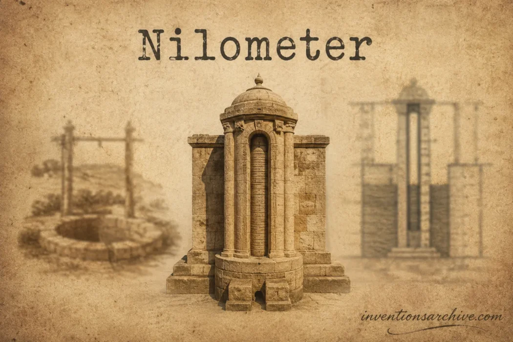
The Rawda monument shows the well-and-column principle clearly. Its stone-lined shaft receives Nile water through openings, while a stair provides access and a central column carries measuring marks. Museum documentation describes the well’s changing geometry, water passages, internal stair, and central octagonal pillar.[b]
The Role Of A Fixed Reference
A useful reading requires more than marks. The zero point, scale, and structure must remain tied to the same reference. Repairs, sediment, erosion, changes in the channel, or altered access can affect interpretation. This is why preserved marks must be studied with the building history around them.
The Cubit Scale
Many nilometers used cubits, divided into smaller units. A cubit was not a decimal metre, and its exact physical length could differ by period, purpose, or local standard. Historians therefore avoid converting every old reading through one universal value without checking the installation and record tradition.
The scale was useful because officials and trained observers understood its divisions. Consistency within a working record mattered more than resemblance to a modern metric gauge.
Materials and Technical Principle
Nilometers were built as durable civil works rather than portable tools. Stone and masonry offered stable reference surfaces and could withstand repeated wetting, although every river structure remained exposed to silt, pressure, erosion, and repair.
- Dressed stone or masonry: formed wells, walls, steps, revetments, and channels.
- Graduated marks: cut into columns, walls, stairways, or adjacent surfaces.
- Water connection: direct river contact, a channel, a culvert, or access to a water level linked with the river.
- Observation access: stairs, corridors, platforms, or internal walkways.
- Reference element: a pillar, wall, step sequence, basin edge, or fixed datum.
- Record system: written logs, announcements, or administrative reports that preserved the reading beyond the moment.
The instrument’s strength came from the union of architecture, measurement, and record keeping. Remove the scale and it becomes only a water structure. Remove the stable water connection and the marks lose meaning. Remove the records and each reading becomes isolated.
Early Uses and Administrative Work
Nilometer readings entered a larger system of water management. Egyptian authorities maintained canals and dykes, watched the seasonal rise, assessed likely irrigation reach, and connected river conditions with agricultural expectations. Research on the Rawda nilometer also shows how practical administration and ceremonial life met around a public measurement institution.[c]
Agriculture and Irrigation
A gauge did not irrigate a field by itself. Its value lay in showing how far the river had risen relative to known levels. That information could support decisions about canal preparation, basin filling, embankment attention, and expected cultivated area.
Farmers still depended on local channels and field conditions. A favourable reading at one place did not mean every parcel received equal water. The nilometer served regional assessment; local distribution remained a separate task.
Taxation and Records
Because the flood affected the area and condition of irrigated land, readings could inform revenue expectations. The relationship was administrative rather than magical: a higher or adequate rise suggested broader irrigation potential, while a poor rise warned of reduced agricultural capacity.
Tax was not read directly from the stone like a price label. Authorities interpreted the level through rules, reports, land records, and current conditions. Different periods used different fiscal practices.
Public Announcement and Ceremony
The annual rise was also a shared public event. At Rawda, readings, announcements, official attendance, and flood celebrations became associated with the monument. The gauge therefore acted as both an instrument and a place where measured environmental change entered civic life.
How The Form Changed Over Time
The nilometer developed through repeated adaptation rather than a single straight line. Builders responded to riverbank shape, local geology, temple or urban setting, measurement custom, and the need to protect the scale.
| Stage | Form | What Changed |
|---|---|---|
| Earlier Practice | Natural markers, bank features, measuring rods, and annual flood-height records | River change was observed and recorded, but surviving evidence does not reveal one standard structure. |
| Fixed Nilometer | Marked steps, walls, columns, basins, wells, or corridors | The reading point became permanent and repeatable at a chosen site. |
| Institutional Gauge | Maintained monument with trained observers, written records, and official reporting | Measurement became part of irrigation management, agricultural assessment, ceremony, and revenue administration. |
| Improved River Gauge | Staff gauge, float gauge, and stilling well with mechanical recorder | Readings could be taken more often and stored as a continuous or regular series. |
| Modern Descendant | Pressure, acoustic, optical, or radar sensor with data logger and telemetry | Water level can be sensed automatically, time-stamped, checked remotely, and transmitted rapidly. |
The Rawda Island Example
The best-dated surviving medieval nilometer stands on Rawda Island in Cairo. Egypt’s Ministry of Tourism and Antiquities records that it was built by order of the Abbasid caliph al-Mutawakkil in 247 AH/861 CE. The monument has a stone-lined well, an octagonal marble column, measuring marks, inscriptions, and a stair descending into the shaft.[d]
Rawda was not the beginning of the invention. It was a later, carefully documented expression of an older measuring tradition. Its survival makes it one of the clearest places to study how a nilometer joined hydraulic design, calibrated measurement, architecture, and administration.
Repair, Recalibration, and Continuity
River structures require maintenance. Stonework can shift, channels can silt, inscriptions can be replaced, and scales can be recut or interpreted under a new standard. A nilometer’s present appearance may therefore combine original work with later repairs.
That layered history is useful evidence. It shows that communities did not merely inherit an old monument; they kept the measuring practice usable under changing institutions and river conditions.
Main Types and Variations
No single classification covers every archaeological example, yet several recurring forms help explain the design choices.
| Type | Typical Form | Reading Method | Design Value |
|---|---|---|---|
| Stairway Or Corridor Gauge | Stone steps or a sloping passage descending toward the river | Water height compared with marks on walls, steps, or an adjacent scale | Direct access across a wide range of river levels |
| Column-In-Well Gauge | Central graduated pillar inside a masonry shaft | Water surface read against marks on the column | Protected scale and a controlled observation space |
| Connected Well Or Cistern | Enclosed chamber reached by channels or culverts from the Nile | Water entering the chamber rises to a corresponding level | Calmer water surface and protection from direct river turbulence |
| Basin Or Temple-Linked Form | Rectangular, circular, or irregular basin near a sacred or administrative complex | Level read from walls, steps, a pillar, or fixed points | Integration with an existing water, ritual, or record-keeping setting |
| Hybrid Or Rebuilt Form | Earlier structure altered with new stairs, scales, inscriptions, or channels | Reading method depends on the surviving phase | Continued use despite architectural and institutional change |
Why Designs Differed
- Bank shape: a steep edge favoured stairs or a shaft; a flatter edge allowed other arrangements.
- Water access: some sites touched the channel directly, while others needed a passage or culvert.
- Protection: enclosed wells reduced exposure to waves and floating material but needed channels kept clear.
- Observation range: long stairs or deep shafts allowed readings across low and high stages.
- Institutional setting: temple, urban, and state-managed sites could place the gauge inside larger architectural spaces.
What Changed Because Of It
The nilometer did not control the Nile. It changed how people described, stored, and acted on information about the river.
- A changing surface became a recorded value. Observers could compare one day with the next and one flood season with another.
- Environmental knowledge became easier to communicate. A number or named threshold travelled more clearly than a vague report that the water looked high.
- Water management gained a shared reference. Canal and dyke preparation could be discussed against measured conditions.
- Agricultural assessment became more ordered. Officials could connect flood stage with likely irrigation reach while still accounting for local conditions.
- Long records became possible. Later historians and hydrologists could study sequences of high and low Nile years.
- Measurement entered public life. Announcements and ceremonies made the seasonal reading understandable beyond the small group who inspected the gauge.
Its lasting value was not the stone alone. It was the practice of observing from a fixed point, using a scale, preserving the result, and comparing the series.
Common Misunderstandings
“One Person Invented The Nilometer”
No named person can be credited securely with the original idea. The evidence points to a long collective development of river observation, calibrated units, fixed structures, and written records.
“The Rawda Monument Was The First Nilometer”
Rawda is a securely dated medieval example, not the beginning of Nile measurement. Flood-height records and older archaeological contexts show that the practice existed far earlier.
“It Predicted The Exact Harvest”
The reading supported an estimate of irrigation conditions. It could not account for every canal, field, crop, storage loss, or local event. It reduced uncertainty without removing it.
“Every Ancient Well Near The Nile Was A Nilometer”
A true identification needs evidence of measurement, such as a scale, suitable hydraulic connection, records, or a clear architectural function. A UCLA Encyclopedia of Egyptology study notes that a deep well at Karnak often labelled a nilometer was more likely connected with the symbolic primeval waters of Nun.[e]
“It Measured The River’s Total Flow”
A nilometer measured stage at one location. Modern discharge measurement also considers channel shape and water velocity. Water level and total flow are related, but they are not the same quantity.
From Nilometers To Modern River Gauging
The modern stream gauge keeps the nilometer’s central idea: measure water height against a stable reference and preserve the reading over time. The methods around that idea have changed.
Staff gauges still provide a visible scale beside a river. Stilling wells allow water to enter through pipes so that stage can be measured in a calmer chamber. Floats, pressure sensors, acoustic devices, optics, and radar can detect level without a person reading every mark. Data loggers add time stamps, while telemetry sends readings to distant offices. The U.S. Geological Survey describes these methods as standard parts of present-day streamgaging.[f]
Why The Nilometer Lost Its Old Role
Modern dams, barrages, perennial irrigation, engineered channels, and instrument networks changed Nile management. The Aswan High Dam ended the former annual flood across the upper Nile Delta floodplain, removing the natural downstream cycle for which traditional nilometers had been maintained.[g]
Historic nilometers now serve mainly as archaeological, architectural, and scientific records. Their scales preserve the history of measurement before automatic sensing, while their buildings show how closely observation once depended on a particular riverbank and institution.
Related Inventions
- Cubit Rod: the linear measuring standard behind many ancient Egyptian scales and subdivisions.
- Basin Irrigation: the field-water system whose reach depended on the seasonal Nile rise.
- Canal and Dyke Systems: structures prepared, maintained, or assessed with knowledge of river stage.
- Water Clock: another technology that converted changing water level into a measured value, though for time rather than river stage.
- Staff Gauge: a fixed graduated scale read directly at a river, canal, lake, or reservoir.
- Stilling Well: a chamber hydraulically connected to a water body, allowing a calmer level to be measured.
- Stream Gauge: a station that records stage and may support calculation of discharge.
- Telemetry Water Station: a sensor-and-communication system that sends level data automatically.
Frequently Asked Questions
Who Invented The Nilometer?
No individual inventor is known. Nile-level measurement developed collectively over a long period through Egyptian observation, metrology, irrigation, administration, and record keeping.
How Old Is The Nilometer?
Records of Nile flood heights reach back to around the beginning of dynastic Egypt, near 3000 BCE. Surviving structures are later and belong to different periods, so the original invention date remains approximate.
What Did A Nilometer Measure?
It measured the height, or stage, of Nile water relative to a fixed scale. It did not directly measure total river discharge, rainfall across the basin, or the exact size of a future harvest.
Were All Nilometers Built The Same Way?
No. Known forms include stairways, marked corridors, columns inside wells, basins, and chambers connected to the river by channels or culverts. Local terrain and building history shaped each design.
Why Are Traditional Nilometers No Longer Used For Nile Management?
Dams, barrages, regulated irrigation, and automatic monitoring changed the river’s seasonal behaviour and the way water data are collected. Historic nilometers are now studied as monuments and records of earlier hydrology.
Sources and Verification
- [a] History of Nile Flows — Used to verify that Nile flood records extend to before 3000 BCE and to distinguish early records from surviving structures. (Reliable because it is an academic chapter published by Cambridge University Press.)
- [b] Nilometer — Discover Islamic Art — Used to verify the architectural form, water passages, internal stair, central pillar, and connection with agricultural taxation. (Reliable because it is an institutional museum database entry for the monument.)
- [c] The Nile as Nexus — Used to verify the links among river gauging, canal and dyke work, harvest assessment, taxation, and ceremony in medieval Egypt. (Reliable because it is an academic chapter published by Cambridge University Press.)
- [d] Rawda Island Nilometer — Used to verify the 861 CE date, patronage, column, well, stair, inscriptions, and measuring marks at Rawda. (Reliable because it is the official monument record of Egypt’s Ministry of Tourism and Antiquities.)
- [e] Karnak: Development of the Temple of Amun-Ra — Used to verify that a Karnak well often labelled a nilometer may instead have had a symbolic water function. (Reliable because it is a UCLA Encyclopedia of Egyptology publication hosted by the University of California.)
- [f] Streamgaging Basics — Used to verify present-day staff gauges, stilling wells, sensors, data recording, and telemetry. (Reliable because it is an official U.S. Geological Survey technical resource.)
- [g] Dam Design and Operation to Optimize Fish Production in Impounded River Basins — Used to verify that the Aswan High Dam ended the former annual flooding of the upper Nile Delta floodplain. (Reliable because it is a technical publication of the Food and Agriculture Organization of the United Nations.)