| Invention Name | Roman Roads Latin: viae Romanae |
|---|---|
| Short Definition | Engineered land routes built and maintained for Roman movement, administration, trade, and communication. |
| Approximate Date / Period | From 312 BCE onward for the Via Appia as the best-known early great Roman road; wider network expanded through the Republic and Empire Based on surviving evidence [a] |
| Geography | Italy first; later Europe, North Africa, Anatolia, the Levant, and other Roman provinces. |
| Inventor / Source Culture | Roman state, surveyors, army engineers, local builders; not one single inventor. Via Appia is linked with Appius Claudius Caecus. |
| Category | Transport; infrastructure; communication; administration; measurement. |
| Evidence Status | Archaeological remains, milestones, road stations, historical itineraries, inscriptions, and modern mapping studies Confirmed and approximate |
| Main Problem Solved | Slow, seasonal, uncertain overland travel between towns, ports, forts, markets, and administrative centers. |
| How It Worked | Surveyed route; raised agger; compacted layers; local stone or gravel; cambered surface; drainage ditches [b] |
| Materials / Technical Basis | Local gravel, stone, sand, timber support in soft ground, paving where needed, drainage control. |
| Early Use | Military movement, official messages, tax and legal administration, market access, passenger travel. |
| Development Path | Older tracks → Roman engineered roads → imperial road network → medieval routes and modern road corridors. |
| Related Inventions | Milestone; bridge; surveying instruments; wagon; road station; aqueduct; paved street. |
| Surviving Evidence | Road earthworks, paving, bridges, cuttings, milestones, inscriptions, itineraries, protected archaeological sites. |
| Modern Descendants | Highways, road surveying, route mapping, distance markers, state road maintenance systems. |
| Why It Matters | Roman roads turned land movement into a planned public system, not just a set of local paths. |
What Roman Roads Were
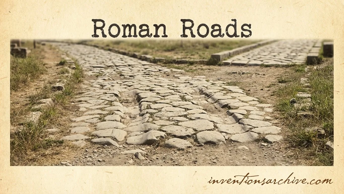
Roman roads were engineered routes for movement. They connected cities, forts, ports, river crossings, mines, farms, markets, and provincial centers. Some were paved with stone. Some were gravel roads. Some were raised earth-and-gravel structures with ditches. Their form depended on local material, terrain, traffic, and purpose.
The phrase Roman road can create a misleading picture of one perfect stone highway repeated everywhere. Real Roman roads varied. A major public road near Rome could look very different from a provincial road built over soft ground or a gravel road serving a rural district.
What made them Roman was not only the surface. It was the combination of surveying, public authority, route planning, drainage, repair, and connection to wider state movement.
The Problem Roman Roads Answered
Before planned road systems, overland travel often followed older paths, seasonal tracks, river valleys, ridgeways, and local routes shaped by habit. These routes could work well for short distances, but they had limits:
- mud, flooding, or uneven ground slowed wheeled transport;
- routes were not always marked or maintained in a consistent way;
- official messages and supplies could lose time between towns;
- military and administrative movement depended heavily on local conditions;
- markets were harder to connect when roads were unreliable.
Roman roads answered these problems by making land movement more predictable. They did not remove every difficulty. Mountains, marshes, rivers, weather, and repair costs still mattered. Yet a planned road made it easier to move people, carts, animals, documents, building materials, taxes, and goods across long distances.
| Before Roman Roads | What Changed After Them |
|---|---|
| Movement often followed local tracks, older paths, ridgeways, and river corridors. | Major settlements and military points were linked by planned, named, and maintained routes. |
| Wet weather and soft ground could make carts slower or less reliable. | Raised road cores, gravel layers, paving in some areas, and drainage reduced seasonal disruption. |
| Distance and route knowledge depended more on local memory. | Milestones, itineraries, and road stations helped record movement and distance. |
| Official communication could be uneven between provinces and central authorities. | Roads supported messengers, officials, administration, tax collection, and legal movement. |
| Trade was still possible, but overland links could be slower and more fragmented. | Towns, farms, ports, and markets gained stronger land connections. |
How Roman Roads Worked in Simple Terms
A Roman road worked by turning a natural route into a prepared surface that could carry repeated traffic. Builders aimed to keep the road firm, drained, and readable in the landscape.
The usual principle was clear: keep the roadbed dry and stable. A raised core, known as an agger, helped lift the road above surrounding ground. Layers of stone or gravel spread weight. A curved or cambered top encouraged rainwater to run toward the sides. Ditches carried water away.
Not every road had the same number of layers. Not every road was paved with large stone slabs. In many places, a gravel surface was practical and easier to repair. In soft ground, timber piles or brushwood could support the roadbed. The Roman method was flexible, not a single universal recipe.
Materials and Technical Principle
The main technical idea behind Roman roads was not decorative paving. It was controlled load, water, and alignment. The road had to hold up under foot traffic, animal traffic, carts, official movement, and repeated repair.
Roadbed
The roadbed was the prepared base. On firm ground, builders could cut, level, and compact the route. On weaker ground, extra support might be needed. A strong roadbed helped prevent the surface from sinking into mud.
Agger
The agger was a raised bank or core. It gave the road height and shape. This helped water move away from the center and made the road more visible across open land.
Surface
The surface could be gravel, small stones, compacted material, or paving blocks. The surface was chosen according to road status, traffic, budget, and available material. A paved surface could last well, but a gravel road could be effective and easier to renew.
Drainage
Ditches beside the road were not minor details. They protected the structure. Without drainage, a road could lose strength even if its surface looked solid.
Durability came from the whole system: route choice, prepared base, layered material, surface shape, side drainage, and maintenance.
Earlier Tracks and Ideas Before Roman Roads
Roman roads did not appear from nothing. Earlier societies used paths, causeways, ridge routes, cart tracks, city streets, military routes, and trade roads. People had long understood that movement needed stable ground and known routes.
The Roman difference was scale and organization. Roads became part of a public landscape. A road could carry soldiers, but it could also guide taxation, settlement, mapping, land division, and official communication. This is why Roman roads belong to transport history and administrative history at the same time.
In some regions, Roman builders reused or upgraded older lines. In other places, they imposed more direct routes. This makes the origin of any single road case-specific. A surviving Roman road line may preserve a Roman-built route, a Roman-upgraded older route, or a route whose exact course changed over time.
Development Path From Earlier Tools to Later Forms
| Stage | Form | What Changed |
|---|---|---|
| Earlier Tool | Footpaths, cart tracks, ridgeways, local stone or earth roads | Movement followed useful terrain but maintenance and long-distance planning were uneven. |
| Roman Invention | Surveyed road corridors with agger, drainage, layers, milestones, and public management | Roads became part of state communication, military logistics, settlement, and administration. |
| Improved Form | Imperial road networks with bridges, road stations, repairs, and mapped itineraries | Longer journeys could be planned through connected towns, ports, and stopping places. |
| Later Continuation | Medieval roads, pilgrimage routes, property boundaries, reused road lines | Some Roman corridors kept practical value even when their original institutions changed. |
| Modern Descendant | Highways, route mapping, distance markers, engineered roadbeds, public road maintenance | Modern roads use different materials and machines, but still rely on surveying, drainage, and planned networks. |
Early Uses in Real Life
Roman roads were not only for armies. They were used by many kinds of travelers and workers. A road that began with military value could later serve market movement, official paperwork, personal travel, religious journeys, and local settlement.
Military Movement
Roads helped troops, equipment, supplies, and messages move between ports, forts, frontiers, and towns. A more reliable road reduced delay and gave commanders better control over distance.
Official Communication
Roman administration needed letters, orders, tax information, legal notices, and reports to move. The road system supported official communication systems and made far provinces easier to govern from administrative centers.
Trade and Local Economy
Farm produce, pottery, stone, timber, metalwork, salt, textiles, animals, and other goods could move along roads to towns and ports. Roads did not replace rivers and sea routes, which were often cheaper for bulk transport. They worked with them.
Daily Travel
Travelers used roads to reach markets, courts, temples, workplaces, towns, and family connections. Roadside settlements, inns, workshops, cemeteries, shrines, and service points developed because roads concentrated movement.
How Roman Roads Spread and Changed
The road network grew as Roman power spread. Italy supplied early major examples. Provinces then gained road systems shaped by military needs, local geography, existing routes, settlement patterns, and administrative plans.
In Britain, for example, the Roman army oversaw rapid road building after the invasion under Claudius in AD 43. Roads linked ports, military points, and developing towns, while officials and messengers used the imperial communication system known later as the cursus publicus. [d]
Modern scholarship now studies Roman roads as networks, not just as famous lines on a map. Stanford’s ORBIS project models movement through roads, rivers, and sea routes to estimate time and expense in Roman travel, which shows that distance alone did not explain ancient connectivity. [e]
This matters because a short road was not always the easiest route. Mountain passes, rivers, seasonal travel, animal transport, sea crossings, and the cost of moving goods all shaped real decisions.
Main Types and Variations
Roman road vocabulary can be confusing because it refers to ownership, status, surface, and function. The most useful distinction is between public roads, local roads, private or estate roads, and surface types.
| Type or Variation | Basic Meaning | Useful Detail |
|---|---|---|
| Via Publica | Public road under state authority | Often a major route; many famous roads belong here. |
| Via Militaris | Road associated with military movement | Function could overlap with major public roads. |
| Via Vicinalis | Local or district road | Connected communities, estates, fields, and larger routes. |
| Via Privata | Private or estate road | Ownership and upkeep could differ from public routes. |
| Via Glareata | Gravel-surfaced road | Practical in many regions and not necessarily inferior for its purpose. |
| Via Munita | Built or paved road | More formal construction, often associated with durable paved sections. |
| Road Station Route | Route with stopping points | Supported official messengers, animal changes, rest, and administration. |
Ancient and later reference traditions describe public, private, and local roads as separate legal or practical categories, while also recording surface differences such as earth, gravel, and built roads. [f]
What Changed Because of Roman Roads
Roman roads changed how space worked inside the Roman world. They made distance more manageable. They made routes easier to remember, mark, and administer. They also helped towns and roadside services grow around movement.
Their influence can be seen in several areas:
- Administration: officials, tax records, legal orders, and messages could move more regularly.
- Military logistics: roads helped connect ports, forts, frontiers, and supply points.
- Commerce: traders gained more reliable land access between towns, farms, workshops, and ports.
- Settlement: roadside villages, stations, cemeteries, markets, and service areas developed near traffic.
- Measurement: milestones and itineraries turned routes into recorded distances.
- Later landscapes: some routes survived as road lines, boundaries, or archaeological features.
The long-term effect should not be overstated. Roman roads did not make all travel easy, cheap, or safe. Sea and river transport remained important, especially for heavy goods. Yet overland movement became more structured, and that changed how provinces were connected.
Surviving Evidence and What It Can Prove
Roman roads survive in different forms. Some are visible as paved sections. Some survive as raised earthworks. Some are sealed beneath modern roads. Others are known from excavations, inscriptions, milestones, bridges, old maps, aerial photography, or a pattern of settlements along a likely route.
A protected section between Waverbridge and Pattenfoot in England, for example, is recorded as a scheduled monument with a preserved cambered agger and archaeological deposits relating to construction, use, and abandonment. The same official record explains how Roman roads in Britain served administration, communication, commerce, settlement, and later landscape use. [g]
This kind of evidence is valuable because it does more than show that a road existed. It can show how the road was built, how it was used, how it changed, and how later communities reused the route.
Common Misunderstandings
“The Romans Invented Roads”
People used paths and roads long before Rome. The Roman innovation was the organized road system: surveyed routes, durable structure, public authority, distance marking, and repair across large territories.
“All Roman Roads Were Straight”
Many major Roman roads aimed for direct lines, especially in open terrain. Yet terrain mattered. Mountains, marshes, rivers, and existing settlements could make a winding route more practical.
“All Roman Roads Were Stone-Paved”
Stone paving is the most recognizable form, but many roads used gravel or compacted local materials. A gravel Roman road could still be engineered, maintained, and important.
“One Person Invented Roman Roads”
Named roads can be linked to officials, patrons, or builders. The road system itself was a collective achievement of state planning, labor, military organization, surveyors, local communities, and later repair.
“A Modern Road on the Same Line Proves the Exact Roman Route”
Sometimes modern roads follow Roman lines. Sometimes they only approximate them. Archaeologists use physical remains, maps, milestones, landscape traces, and excavation before making firm claims.
Related Inventions and Later Developments
- Milestones: distance markers that helped record route position and official road works.
- Roman Bridges: stone and timber structures that extended road movement across rivers and ravines.
- Surveying Instruments: tools used to plan alignments, angles, and land divisions.
- Wagons and Carts: wheeled transport that made road quality economically important.
- Road Stations: stopping places, horse-change points, and service sites tied to travel systems.
- Aqueducts: another Roman engineering system that shared surveying, masonry, and public planning skills.
- Paved Streets: urban surfaces connected to drainage, traffic, and civic design.
- Modern Highways: later road networks that still depend on route planning, drainage, and public maintenance.
Frequently Asked Questions
Who invented Roman roads?
Roman roads were not invented by one person. They were a collective Roman infrastructure system built by state authorities, military engineers, surveyors, local labor, contractors, and communities. Some famous roads, such as the Via Appia, are linked with named officials.
Were Roman roads always paved with stone?
No. Some major roads had durable stone paving, but many Roman roads used gravel, compacted local material, raised banks, and drainage ditches. Road form depended on location, material, traffic, and purpose.
Why were Roman roads so durable?
Their durability came from prepared foundations, compacted layers, raised roadbeds, drainage, repair, and careful route planning. The visible paving was only one part of the system.
Did all Roman roads lead to Rome?
The saying captures Rome’s central role, but it is not literally true for every road. The network included provincial, local, military, and secondary roads that connected many places without running directly to Rome.
What is the earliest famous Roman road?
The Via Appia, begun from 312 BCE, is the best-known early great Roman road. It connected Rome toward southern Italy and later became one of the most important routes in Roman transport history.
Sources and Verification
- [a] Via Appia. Regina Viarum – UNESCO World Heritage Centre — Used to verify the Via Appia’s date range, length, early status, association with Appius Claudius Caecus, and strategic role. (Reliable because it is an official UNESCO World Heritage Centre page.)
- [b] Roads in Roman Britain | English Heritage — Used to verify Roman road structure, agger, layered construction, local materials, drainage ditches, and width variation in Britain. (Reliable because it is an official English Heritage educational source.)
- [c] Itiner-e: A high-resolution dataset of roads of the Roman Empire | Scientific Data — Used to verify modern research on mapped road length, certainty categories, and evidence limits in the Roman road network. (Reliable because it is a peer-reviewed Scientific Data article published by Nature Portfolio.)
- [d] Roads in Roman Britain | English Heritage — Used to verify Roman road building in Britain after AD 43 and the role of roads in military, official, and messenger movement. (Reliable because it is an official English Heritage educational source.)
- [e] ORBIS: The Stanford Geospatial Network Model of the Roman World | Department of History — Used to verify the use of roads, rivers, and sea routes in modeling Roman travel time and cost. (Reliable because it is a Stanford University Department of History source.)
- [f] LacusCurtius • Viae (Smith’s Dictionary, 1875) — Used to verify classical terminology for public, private, local, earth, gravel, and built Roman roads. (Reliable because it is a digitized classical reference text hosted on a University of Chicago domain.)
- [g] Roman road, Waverbridge to Pattenfoot, Boltons – 1004616 | Historic England — Used to verify a protected surviving Roman road earthwork, agger preservation, archaeological deposits, and official interpretation of road function. (Reliable because it is an official Historic England National Heritage List entry.)